Welcome to the BC HighwayCams website, where you can view highway conditions, traffic, and weather information at a glance.
To view BC HighwayCams, select one of the tabs below and click on a thumbnail. (NR-Northern Region; SIR-Southern Interior Region; LM-Lower Mainland; VI-Vancouver Island; Brdr-Border; All-All webcams; MyCams-Customize your own page of images.)
Please note all BC HwyCams use Pacific Time Zone (PT).
 Attention motorists:
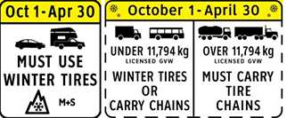
Spring weather can make highway conditions in B.C. unpredictable, particularly through high mountain passes. Please be prepared and be aware that winter tires and chains may still be needed.
Winter tires or chains are required on most routes in British Columbia from October 1 to April 30. For select highways not located through mountain passes and/or high snowfall areas, tire and chain requirements end March 31. These routes are marked with regulatory signs posted on highways throughout the province. We reserve the right to restrict travel at any time of the year depending on road conditions.
Click for more information
 | NR |  |  | SIR |  |  | LM |  |  | VI |  |  | Brdr |  |  | All |  |  | MyCams |  |
| |||||||
Highway 2 |  Tupper - W Highway 2 about 2 km west of BC/Alberta border at Highway 2 and Highway 52 junction, looking west. |  Tupper - E Highway 2 about 2 km west of BC/Alberta border at Highway 2 and Highway 52 junction, looking east. | |||||
Highway 5 | |||||||
Highway 16 | |||||||
 Rainbow Summit Chain-Up Area Highway 16 about 34 km east of Prince Rupert near McNeil River at the Rainbow Summit chain-up area, looking west. | |||||||
 Terrace - E Highway 16 at Highway 37S on the border of Terrace and Thornhill, looking east on Highway 16. | |||||||
 Chimdemash Highway 16 near Chimdemash Creek about 22 km east of Highway 16 and Highway 37 junction in Terrace, looking north. | |||||||
 Bednesti Lake - W Highway 16 at Bobtail Forest Road near Bednesti Lake between Prince George and Vanderhoof, looking west. |  Bednesti Lake - E Highway 16 at Bobtail Forest Road near Bednesti Lake between Prince George and Vanderhoof, looking east. | ||||||
 Red Pass Highway 16 about 27 km east of Tete-Jaune Junction and 40 km west of BC-Alberta border, looking east. |  BC-Alberta Border Highway 16 about 0.5 km west of the BC-Alberta border and 1 km to Jasper in Alberta, looking west. | ||||||
Highway 27 | |||||||
Highway 29 |  Hudson's Hope - NE Highway 29 about 1.5 km north of Hudson's Hope at Powell Road, looking northeast. |  Hudson's Hope - SW Highway 29 about 1.5 km north of Hudson's Hope at Powell Road, looking southwest. | |||||
Highway 35 |  Martin Road - N Highway 35 near Martin Road between Burns Lake and Francois Lake Northbank Ferry Landing, looking north. |  Martin Road - S Highway 35 near Martin Road between Burns Lake and Francois Lake Northbank Ferry Landing, looking south. |  Francois Lake Northbank Ferry Landing Highway 35 at Francois Lake Northbank Ferry Landing, looking at lineup. |  Francois Lake Southbank Ferry Landing Highway 35 at Francois Lake Southbank Ferry Landing, looking north at ferry ramp. | |||
Highway 37 | |||||||
Highway 37A | |||||||
Highway 0 (Cecil Lake Rd) | |||||||
Highway 97 (Northern Region) |  Liard Highway Junction Highway 97 at Highway 77 junction about 28 km north of Fort Nelson, looking east. | ||||||
 Sikanni Chief Highway 97 about 6 km south of the Sikanni River Bridge and about 175 km north of Fort St. John, looking north. | |||||||
 South Taylor Hill - N Highway 97 about 20 km south of Fort St. John at South Taylor Hill, looking north. |  South Taylor Hill - S Highway 97 about 20 km south of Fort St. John at South Taylor Hill, looking south. | ||||||
 Whiskers Point - N Highway 97 near Whiskers Point Provincial Park entrance on the east side of McLeod Lake, looking north. | |||||||
 Whiskers Point - S Highway 97 near Whiskers Point Provincial Park entrance on the east side of McLeod Lake, looking south. |  Summit Lake Road - N Highway 97 about 49 km north of Prince George at Summit Lake Road, looking north. |  Summit Lake Road - W Highway 97 about 49 km north of Prince George at Summit Lake Road, looking west. |  Summit Lake Road - S Highway 97 about 49 km north of Prince George at Summit Lake Road, looking south. | ||||
 Prince George northbound Highway 97 at Highway 16 junction in Prince George, looking northbound on Highway 97. | |||||||
 Prince George westbound Highway 97 at Highway 16 junction in Prince George, looking westbound on Highway 16. |  Prince George eastbound Highway 97 at Highway 16 junction in Prince George, looking eastbound on Highway 16. |  Prince George southbound Highway 97 at Highway 16 junction in Prince George, looking southbound on Highway 97. |  Chamulak Road Highway 97 about 36 km south of Prince George at Chamulak Road in Stoner, looking north. | ||||
Highway 113 |  Grizzly Hill Highway 113 (Nass Road) about 3 km southwest of Village of Laxgalts'ap (Greenville), looking west. |  Gitwinksihlkw Highway 113 at Anlaw Road near Gitwinksihlkw, within Nisga'a Memorial Lava Bed Provincial Park, looking east. | |||||
Highway 118 |  Granisle Highway Granisle Highway (Highway 118), near summit. Approximately 14.5 km north of Topley, looking north. | ||||||
| |||||||
Highway 1 (Trans Canada Highway) | |||||||
 Boston Bar - N Highway 1 about 12 km north of Boston Bar at Kahmoose Road in Boothroyd, looking north. |  Boston Bar - S Highway 1 about 12 km north of Boston Bar at Kahmoose Road in Boothroyd, looking south. | ||||||
 Jackass Mountain - N Highway 1 between Boston Bar and Lytton at Jackass Mountain summit by CəX̣ʷ Cixʷ (Check-Chow) Bridge, looking north. |  Jackass Mountain - S Highway 1 between Boston Bar and Lytton at Jackass Mountain summit by CəX̣ʷ Cixʷ (Check-Chow) Bridge, looking south. | ||||||
 Spences Bridge Highway 1 at the north end of Spences Bridge on the west side of the Thompson River, looking north. | |||||||
 Sorrento - Blind Bay Highway 1 at Highland Drive east of Sorrento at the Blind Bay turn off, looking southeast. | |||||||
 Rogers Pass Highway 1 about 72 km east of Revelstoke at Rogers Pass in Glacier National Park, looking east. |
New!
| ||||||
Highway 0 (Adams Lake) |  Adams Lake West Ferry Landing Adams Lake Ferry west shore landing, looking at ferry landing on west side of lake. |  Adams Lake West Ferry Lineup Adams Lake Ferry west shore landing, looking at ferry line up toward Rawson Road. |  Adams Lake East Ferry Landing Adams Lake Ferry east shore landing, looking at ferry landing on east side. | ||||
Highway 3 |  Allison Pass - W Highway 3 about 10 km west of Manning Park resort area at Allison Pass, looking west. | ||||||
New!
| |||||||
 Eholt Summit Highway 3 about 16 km northeast of Greenwood at Wilgress Rest Area near Eholt Summit, looking westbound. |
New!
| ||||||
New!
| |||||||
New!
|
New!
| ||||||
 Sparwood Highway 3 about 2 km west of the Alberta border at Sparwood Weigh Scale, looking southeast. | |||||||
Highway 3A |  Glade Ferry Terminal - W Highway 3A at Glade Ferry Road, looking at ferry landing on west side of river. |  Glade Ferry Terminal - E Highway 3A at Glade Ferry Road, looking at ferry landing on east side of river. | |||||
 Harrop Ferry Landing North View Harrop Ferry Landing on south side of Kootenay Lake, looking at the north side landing. |  Balfour Ferry Approach - NE Highway 3A and Highway 31 at Balfour ferry terminal entrance near Ferry Landing Road, looking northeast. |  Balfour Ferry Busk Road Parking Highway 3A and Highway 31 at Busk Road near the Balfour ferry terminal, looking at ferry parking lot. | |||||
 Balfour Ferry Approach - SW Highway 3A and Highway 31 at Balfour ferry terminal entrance of Ferry Landing Road, looking southwest. | |||||||
Highway 3A (Kaleden to Keremeos) | |||||||
Highway 3B |  Strawberry Pass - NW Highway 3B about 15 km north of Rossland and 4 km south of summit, looking north. |
New!
 Strawberry Pass - SE Highway 3B about 15 km north of Rossland and 4 km south of summit, looking south. |  Rossland northbound Highway 3B at Highway 22 near the Rossland Weigh Scale, northbound on Highway 3B. | ||||
 Rossland southound Highway 3B at Highway 22 near the Rossland Weigh Scale, southbound on Highway 22. |
New!
| ||||||
Highway 5 (Coquihalla) | 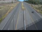 Hwy 5 at Hwy 97D northbound Highway 5 at Exit 366 Logan Lake/Lac le Jeune Road, looking northbound along Highway 5. | ||||||
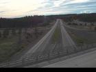 Hwy 5 at Hwy 97D southbound Highway 5 at Exit 366 Logan Lake/Lac le Jeune Road, looking southbound along Highway 5. |
New!
| ||||||
 Zopkios Southbound - N Highway 5 southbound at Zopkios Rest Area near the Coquihalla Summit, looking north. |  Zopkios Southbound - S Highway 5 southbound at Zopkios Rest Area near the Coquihalla Summit, looking south. |  Zopkios Northbound - N Highway 5 northbound at Zopkios Rest Area near the Coquihalla Summit looking north. | |||||
 Zopkios Northbound - S Highway 5 northbound at Zopkios Rest Area near the Coquihalla Summit looking south. | |||||||
Highway 5 | |||||||
 Halston Avenue / Paul Lake Road - N Highway 5 at Halston Avenue / Paul Lake Road in Kamloops, looking north. |  Halston Avenue / Paul Lake Road - W Highway 5 at Halston Avenue / Paul Lake Road in Kamloops, looking west. |  Halston Avenue / Paul Lake Road - E Highway 5 at Halston Avenue / Paul Lake Road in Kamloops, looking east to Paul Lake Road. |  Halston Avenue / Paul Lake Road - S Highway 5 at Halston Avenue / Paul Lake Road in Kamloops, looking south. | ||||
Highway 6 | |||||||
 Needles Ferry Bend End Highway 6 at Needles Ferry Landing, looking west away from ferry landing towards Needles Road N. |  Needles Ferry Rest Area Highway 6 at Needles Ferry Landing, looking east towards front of line up near the rest area. | ||||||
 Burton Main Road Highway 6 in Burton at Burton Main Road, about 22 km north of Fauquier, looking south. |  Arrow Park Ferry North Terminal Highway 6 at South Arrow Park Ferry Terminal, 22 km south of Nakusp at junction of Upper and Lower Arrow Lakes, looking at north landing. | ||||||
 Arrow Park Ferry South Terminal - N Highway 6 at South Arrow Park Ferry Terminal, 22 km south of Nakusp at junction of Upper and Lower Arrow Lakes, looking north. |  Arrow Park Ferry South Terminal - S Highway 6 at South Arrow Park Ferry Terminal, 22 km south of Nakusp at junction of Upper and Lower Arrow Lakes, looking south on Arrow Park Road. |
New!
| |||||
Highway 5A |
New!
|
New!
| |||||
Highway 20 |  Heckman Summit Highway 20 about 88 km from Bella Coola and 41 km from Anahim Lake, near gate at top of Bella Coola hill, looking west. | ||||||
Highway 23 |  Blanket Creek - N Highway 23 about 30 km south of Revelstoke and 22 km north of Shelter Bay Ferry, looking north. | ||||||
 Blanket Creek - S Highway 23 about 30 km south of Revelstoke and 22 km north of Shelter Bay Ferry, looking south. |  Shelter Bay - End Highway 23 near the Upper Arrow Lake ferry landing at Shelter Bay, end of queue, looking north. |  Shelter Bay - Lineup Highway 23 near the Upper Arrow Lake ferry landing at Shelter Bay, looking north at lineup. |
New!
 Shelter Bay - Ferry Ramp Highway 23 near the Upper Arrow Lake ferry landing at Shelter Bay, looking south at terminal ramp. | ||||
 Galena Bay Landing - End Highway 23 near the Upper Arrow Lake ferry landing at Galena Bay, looking at end of lineup. |  Galena Bay Landing - Front Highway 23 near the Upper Arrow Lake ferry landing at Galena Bay, looking at front of lineup. |
New!
 Galena Bay Landing - Lineup Highway 23, at the bottom of the Upper Arrow Lake ferry landing at Galena Bay, looking at lineup. |
New!
 Galena Bay Landing - Ferry Ramp Highway 23, at the bottom of the Upper Arrow Lake ferry landing at Galena Bay, looking at ferry boarding. | ||||
Highway 24 | |||||||
Highway 26 | |||||||
Highway 31 |
New!
|
New!
| |||||
Highway 31A | |||||||
Highway 33 |  McCulloch - N Highway 33 about 41 km southeast of Kelowna, just south of Big White Road, looking north. |  McCulloch - S Highway 33 about 41 km southeast of Kelowna, just south of Big White Road, looking south. |  Highbridge - N Highway 33 about 14 km north of Westbridge and 20 km south of Beaverdell, looking north. |
New!
 Highbridge - S Highway 33 about 14 km north of Westbridge and 20 km south of Beaverdell, looking south. | |||
Highway 43 | |||||||
 Line Creek Mine Road Highway 43 between Sparwood and Elkford at Line Creek Mine Road, looking north. | |||||||
Highway 93 |  Radium Hot Springs northbound Highway 93/95 roundabout at Radium Hot Springs, looking northbound on Highway 95. |  Radium Hot Springs eastbound Highway 93/95 roundabout at Radium Hot Springs, looking eastbound on Highway 93. |  Radium Hot Springs southbound Highway 93/95 roundabout at Radium Hot Springs, looking southbound on Highway 93/95. | ||||
Highway 0 (Toby Creek Road) | |||||||
Highway 95 | |||||||
Highway 95A | |||||||
Highway 97 (Southern Interior Region) | |||||||
 McLeese Lake - SE Highway 97 and Beaver Lake Road junction north of McLeese Lake, looking southeast. | 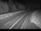 Bull Mountain - N Highway 97 north of Williams Lake near the turn off to the Bull Mountain ski area, looking north. | 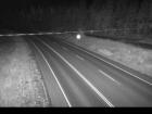 Bull Mountain - S Highway 97 north of Williams Lake near the turn off to the Bull Mountain ski area, looking south, | |||||
 Begbie Summit Highway 97 at Lookout Road near Begbie Summit about 21 km south of 100 Mile House, looking north. | |||||||
 WR Bennett Bridge 11 WR Bennett Bridge east approach at Abbott Street, looking west along Highway 97. |  Highway 97 at Highway 97C - N Highway 97 at Highway 97C junction about 5 km south of Westbank, looking north. | ||||||
 Highway 97 at Highway 97C - W Highway 97 at Highway 97C junction about 5 km south of Westbank, looking west. | 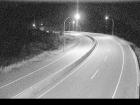 Highway 97 at Highway 97C - E Highway 97 at Highway 97C junction about 5 km south of Westbank, looking east. |  Highway 97 at Highway 97C - S Highway 97 at Highway 97C junction about 5 km south of Westbank, looking south. |  Callan Road Highway 97 at Callan Road, about 6 km north of Summerland and 15 km south of Peachland, looking south. | ||||
Highway 97A | |||||||
Highway 97C |  Highland Valley Road - N Highway 97C at Highland Valley Road between Merritt and Ashcroft, looking north. |  Highland Valley Road - S Highway 97C at Highland Valley Road between Merritt and Ashcroft, looking south. |  Aspen Grove - N Highway 97C (Okanagan Connector) at Highway 5A junction near Aspen Grove, looking north. |  Aspen Grove - S Highway 97C (Okanagan Connector) at Highway 5A junction near Aspen Grove, looking south. | |||
Pothole Lake - W Highway 97C (Okanagan Connector) about 7 km east of Aspen Grove near Pothole Lake, looking west. | Pothole Lake - E Highway 97C (Okanagan Connector) about 7 km east of Aspen Grove near Pothole Lake, looking east. |  Elkhart - W Highway 97C (Okanagan Connector) about 25 km east of Highway 5A and Highway 97C junction, looking west. |  Elkhart - E Highway 97C (Okanagan Connector) about 25 km east of Highway 5A and Highway 97C junction, looking east. | ||||
New!
|  Brenda Mine - W Highway 97C (Okanagan Connector), about 22 km west of Highway 97 and Highway 97C junction, looking west. |  Brenda Mine - E Highway 97C (Okanagan Connector) about 22 km west of Highway 97 and Highway 97C Junction, looking east. | |||||
| |||||||
Highway 1 (Horseshoe Bay to Lynn Valley) | |||||||
Highway 1 (Ironworkers Memorial Bridge to Port Mann) | |||||||
 Ironworkers North approach - N Highway 1 at the northend of Ironworkers Memorial Bridge by Fern Street, looking northbound. |  Ironworkers North approach - S Highway 1 at the northend of Ironworkers Memorial Bridge by Fern Street, looking southbound. | ||||||
 Ironworkers South westbound Highway 1 at the south end of Ironworkers Memorial Bridge, looking westbound towards the North Shore. |  Ironworkers South eastbound Highway 1 at the south end of Ironworkers Memorial Bridge, looking eastbound toward the Cassiar Tunnel. | ||||||
Highway 1 (Fraser Valley) | |||||||
Highway 0 (Chilliwack Lake Road) |  Chilliwack Lake Chilliwack Lake Road, at Paulsen Road. About 42 km east of Chilliwack, looking east. | ||||||
Highway 0 (Golden Ears Way) |  Golden Ears Way at Wharf Street North end of Golden Ears Bridge at Wharf Street, looking southbound. |  Golden Ears Way at 199A Avenue and 200 Street Golden Ears Way, at 199A Avenue off-ramp and 200 Street on-ramp, looking northbound. | |||||
Highway 7 (Lougheed Highway) |  Lougheed at Kennedy Road Highway 7 (Lougheed Highway) at Kennedy Road, looking northwest towards Pitt River Bridge. | ||||||
 Lougheed at Dewdney Trunk Road - N Highway 7 (Lougheed Highway) at Dewdney Trunk Road, looking north. | |||||||
 Lougheed at Dewdney Trunk Road - E Highway 7 (Lougheed Highway) at Dewdney Trunk Road, looking east. |  Lougheed at Maple Meadows Way - S Highway 7 (Lougheed Highway) at Maple Meadows Way/Dewdney Trunk Road, looking south. |  Lougheed at Haney Bypass - N Highway 7 (Lougheed Highway) at Haney Bypass/222 Street, looking north. | |||||
 Lougheed at Haney Bypass - S Highway 7 (Lougheed Highway) at Haney Bypass/222 Street, looking south. | |||||||
 Kanaka Way at Lougheed - westbound Westbound on Highway 7 (Lougheed Highway) at Kanaka Way/Haney Bypass. |  Kanaka Way at Lougheed - eastbound Eastbound on Highway 7 (Lougheed Highway) at Kanaka Way/Haney Bypass. | ||||||
 Silverdale - N Highway 7 (Lougheed Highway) at Hayward Street in Mission, looking north along Hayward Street. |  Silverdale - W Highway 7 (Lougheed Highway) at Hayward Street in Mission, looking westbound along Highway 7. |  Silverdale - E Highway 7 (Lougheed Highway) at Hayward Street in Mission, looking eastbound along Highway 7. | |||||
 Silverdale - S Highway 7 (Lougheed Highway) at Hayward Street in Mission, looking south to Hayward Street. | |||||||
 Highlands Boulevard - W Highway 7 (Lougheed Highway) about 3 km east of Harrison Mills at Highlands Boulevard, looking west |  Highlands Boulevard - E Highway 7 (Lougheed Highway) about 3 km east of Harrison Mills at Highlands Boulevard, looking east. | ||||||
Highway 7B (Mary Hill Bypass) | |||||||
 Mary Hill Bypass at Broadway - N Hwy 7B (Mary Hill Bypass), at Broadway St in Port Coquitlam, looking north. |  Mary Hill Bypass at Broadway - W Hwy 7B (Mary Hill Bypass), at Broadway St in Port Coquitlam, looking west. | ||||||
 Mary Hill Bypass at Broadway - E Hwy 7B (Mary Hill Bypass), at Broadway St in Port Coquitlam, looking east. | |||||||
Highway 9 | |||||||
Highway 10 |  Hwy 10 at King George Boulevard - W Highway 10 at King George Boulevard, looking west on Highway 10. |  Hwy 10 at King George Boulevard - E Highway 10 at King George Boulevard, looking east on Highway 10. | |||||
Highway 11 (Abbotsford Mission Hwy) | |||||||
Highway 0 (Barnston) | |||||||
Highway 15 (South Surrey - Whiterock) | |||||||
Highway 17 |  Deltaport Way - N Hwy 17 (South Fraser Perimeter Rd) at Deltaport Way in South Delta, looking north. |  Deltaport Way - S Hwy 17 (South Fraser Perimeter Rd) at Deltaport Way in South Delta, looking south. | |||||
Hwy 17 at Hwy 91 Connector - N Hwy 17 (South Fraser Perimeter Rd), at Hwy 91 Connector, looking north. | Hwy 17 at Hwy 91 Connector - W Hwy 17 (South Fraser Perimeter Rd), at Hwy 91 Connector, looking west. | Hwy 17 at Hwy 91 Connector - E Hwy 17 (South Fraser Perimeter Rd), at Hwy 91 Connector, looking east. | |||||
 Tannery Road - N Highway 17 (South Fraser Perimeter Road) at Tannery Road Overpass in Surrey, looking north. |  Tannery Road - W Highway 17 (South Fraser Perimeter Road) at Tannery Road Overpass in Surrey, looking west. |  Tannery Road - E Highway 17 (South Fraser Perimeter Road) at Tannery Road Overpass in Surrey, looking east. |  Tannery Road - S Highway 17 (South Fraser Perimeter Road) at Tannery Road Overpass in Surrey, looking south. | ||||
Highway 17A | |||||||
Highway 91A (New Westminster / Queensborough) |  Hwy 91A at Queensborough Bridge - E Highway 91A at the north end of Queensborough Bridge, looking east. |  Hwy 91A at Queensborough Bridge - S Highway 91A at the north end of Queensborough Bridge, looking south. | |||||
 Queensborough Connector Highway 91A at Highway 91 interchange to Queensborough Connector, looking north. | |||||||
Highway 0 (Knight Street) | |||||||
Highway 91 (Alex Fraser Bridge) |  Annacis Channel Bridge Approach Hwy 91 at Hwy 91A interchange, looking northeast to Annacis Channel Bridge approach. | ||||||
Highway 91 (East-West Connector) |  Hwy 91 East-West Connector - W Hwy 91 at Hwy 91A Interchange, looking west on the East-West Connector. | ||||||
Highway 91 (Delta) | |||||||
Highway 99 (Whistler to Lillooet) |  Lillooet-Fountain Valley Highway 99 about 15 km north of Lillooet near Fountain Slide, looking southwest. | ||||||
Highway 99 (Sea-to-Sky Highway) | |||||||
Highway 99 (Lions Gate Bridge/Marine Drive) | |||||||
Highway 99 (Oak Street Bridge - Richmond) |  Oak St at 70 Avenue - N Oak Street at 70 Avenue, north approach to Oak Street Bridge, looking north on Oak Street. |  Oak St at 70 Avenue - S Oak Street at 70 Avenue, north approach to Oak Street Bridge, looking south to the bridge. | |||||
Highway 99 (George Massey Tunnel) |  Hwy 99 at Hwy 17A - W Highway 99 at Highway 17A overpass, looking west on Highway 99 at northbound lanes. | ||||||
 Hwy 99 at Hwy 17A - E Highway 99 at Highway 17A overpass, looking east at southbound lanes on Highway 99. | |||||||
Highway 99 (Delta to Surrey) | |||||||
 Hwy 99 at Mud Bay - W Highway 99, near Highway 91 around Mud Bay in Surrey, looking west on Highway 99 northbound. |  Hwy 99 at Mud Bay - E Highway 99, near Highway 91 around Mud Bay in Surrey, looking east on Highway 99 southbound. | ||||||
Highway 99 (Surrey to White Rock) | |||||||
Highway 99A (King George Blvd) | |||||||
Highway 101 (Sunshine Coast) | |||||||
| |||||||
Highway 1 (Vancouver Island) | |||||||
 Herd Road - N Highway 1 about 5 km north of Duncan at Herd Road/Cowichan Valley Highway, looking north. |  Herd Road - W Highway 1 about 5 km north of Duncan at Herd Road/Cowichan Valley Highway, looking west. |  Herd Road - E Highway 1 about 5 km north of Duncan at Herd Road/Cowichan Valley Highway, looking east. |  Herd Road - S Highway 1 about 5 km north of Duncan at Herd Road/Cowichan Valley Highway, looking south. | ||||
 Butterfield Road - N Highway 1 at Butterfield Road, approximately 3 km south of Mill Bay, looking north. | |||||||
 Butterfield Road - S Highway 1 at Butterfield Road, approximately 3 km south of Mill Bay, looking south. |  Bamberton - N Highway 1 south of Mill Bay Rd Overpass at the Bamberton Park Entrance, looking north. |  Bamberton - S Highway 1 south of Mill Bay Road Overpass at the Bamberton Park Entrance, looking south. | |||||
 Hwy 1 at West Shore Parkway northbound Highway 1 at West Shore Parkway, looking northbound toward Goldstream Park. | |||||||
 Hwy 1 at West Shore Parkway southbound Highway 1 at West Shore Parkway, looking southbound towards Victoria. | |||||||
Highway 4 |  Ucluelet-Tofino Highway - E Highway 4 at Ucluelet-Tofino Highway junction, looking east to Highway 4. |  Ucluelet-Tofino Highway - S Highway 4 at Ucluelet-Tofino Highway junction, looking south towards Ucluelet. | |||||
 Taylor River - W Highway 4 about 37 km west of Port Alberni at turn off for Taylor River Rest Area, looking west. |  Taylor River - E Highway 4 about 37 km west of Port Alberni at turn off for Taylor River Rest Area, looking east. |  Highway 4 at Alberni Highway - N Highway 4 at Alberni Highway (Highway 4A) junction, about 2 km west of Coombs, looking north. | |||||
 Highway 4 at Alberni Highway - W Highway 4 at Alberni Highway (Highway 4A) junction, about 2 km west of Coombs, looking west. | 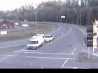 Highway 4 at Alberni Highway - E Highway 4 at Alberni Highway (Highway 4A) junction, about 2 km west of Coombs, looking east. | ||||||
Highway 14 | |||||||
 Hwy 14 at West Shore Parkway - N Highway 14 at West Shore Parkway, looking north to West Shore Parkway. |  Veteran's Memorial Parkway - N Highway 14 (Veteran's Memorial Parkway) at Goldstream Avenue in Langford, looking north. | ||||||
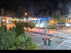 Veteran's Memorial Parkway - W Highway 14 (Veteran's Memorial Parkway) at Goldstream Avenue in Langford, looking west. |  Veteran's Memorial Parkway - E Highway 14 (Veteran's Memorial Parkway) at Goldstream Avenue in Langford, looking east. |  Veteran's Memorial Parkway - S Highway 14 (Veteran's Memorial Parkway) at Goldstream Avenue in Langford, looking south. | |||||
Highway 17 (Victoria) | |||||||
 Hwy 17 at Saanich Road 1 - N Highway 17 (Blanshard Street) southbound at Saanich Road, looking north. |  Hwy 17 at Saanich Road 1 - E Highway 17 (Blanshard Street) southbound at Saanich Road, looking east. | ||||||
 Hwy 17 at Saanich Road 1 - S Highway 17 (Blanshard Street) southbound at Saanich Road, looking south. | |||||||
Highway 18 | |||||||
Highway 0 (Cowichan Lake) | |||||||
Highway 19 |
New!
|
New!
|
New!
|  Hwy 19 at Port Alice Road Highway 19 at Highway 30 (Port Alice Road) between Port Hardy and Port McNeill, looking south. | |||
 Hyde Creek Road - W Highway 19 about 4.5 km south of Port McNeill near Hyde Creek Road, looking west. |  Hyde Creek Road - E Highway 19 about 4.5 km south of Port McNeill near Hyde Creek Road, looking east. | ||||||
 Woss Highway 19 about 75 km southeast of Port McNeill and 128 km north of Campbell River, looking east. |  Tsitika Highway 19 about 101 km north of Campbell River and about 27 km south of Woss near Tsitika, looking southeast. |  Menzies Hill - N Highway 19 about 7 km southeast of Roberts Lake and 24 km north of Campbell River at Menzies Hill, looking north. | |||||
 Menzies Hill - S Highway 19 about 7 km southeast of Roberts Lake and 24 km north of Campbell River at Menzies Hill, looking south. |  Duncan Bay - N Highway 19 north of Campbell River between Orange Point Road and Duncan Bay Road, looking north. |  Duncan Bay - S Highway 19 north of Campbell River between Orange Point Road and Duncan Bay Road, looking south. | |||||
Highway 19A | |||||||
 Hwy 19A at 17 Street Bridge - S Highway 19A at 17 Street Bridge in Courtenay, looking southbound on Comox Road. | |||||||
Highway 28 |  Gold River Highway Highway 28 (Gold River Highway) about 24 km west of Campbell River, looking west. | ||||||
| |||||||
Highway 11 (Canada/US Border Crossing) | |||||||
Highway 13 (Canada/US Border Crossing) |  Hwy 13 at 264 Street Diversion - N Highway 13 at 264 Street Diversion, south of 8 Avenue, looking north. |  Hwy 13 at 264 Street Diversion - S Highway 13 at 264 Street Diversion, south of 8 Avenue, looking south. | |||||
Highway 15 (Canada/US Border Crossing) | |||||||
Highway 93 (Canada/USA Border Crossing) | |||||||
Highway 99 (Peace Arch Border Crossing) |  Hwy 99 at 8 Avenue - W Highway 99 at 8 Avenue in White Rock, looking west at southbound ramp from 8 Avenue. | ||||||


